If time is money and you have more time, Do you need more money?

Friday, December 28, 2012

Surfing In To Cortez And Slamming Into Longbeach

We left our anchorage just out side McDondald's hoping to cash in on the north east and east winds today.  After making if through the draw bridge we kept the motor running as the wind was erratic and multi-directional.  We were unable get any predictable winds until we were going through structure "C" bridge.  With Teirra Verde bridge  just ahead we kept the sails down and good thing we missed Teirra Verde by 5 minutes and they have a new every half hour schedule.  As the boats stacked up at this barrier only one did so with a sail, not us.

As we approached the causeway to the SunshineSkyway Parkway we raised the sails and took the ditch running south know as Sunshine Skyway channel.  This is a little shortcut right along side the parkway.  It cuts about 5 miles off the journey as opposed to following the ICW.  We were now sailing across Tampa Bay.  Finally with winds.

 As we sailed across Tampa Bay the wind increased as did the waves.  By the time we reached the intercoastal on the south side of the bay the waves were becoming more uniform.  They were also building as they entered the shallows.  While we were more sliding than surfing on these little 3 footers, surfing made a better title.  Our timing at Anna Maria bridge was perfect and we followed a Benneton down the ICW toward Cortez.  Our sails up and them obviously not motoring at full throttle.  The spacing of these bridges allows us to make both in sequence, just barely.


We are getting a better grasp on the prevailing wind vs the sea breeze.  To simplify it 10 knts or less the seabreeze, whether on shore or off shore really messes with things.  With early morning and late afternoon most effected.  Mid day the winds die down.  At 20 knts the prevailing wind takes control.  Now in between 10 and 20 you can flip a coin.   Take into account the number of high-rise condos, land mass, color of the ground surface and you realize the rules just going to be different around the next bend.

As we passed through the Cortez bridge the cloud cover started to return and made it seem closer to sunset than it really was.  Thinking about a place to anchor (I have hand drawn anchors all over the charts from previous trips so as not to have to think too hard) I grabbed the iPhone and clicked up Active Captain. I scrolled through the anchorages from here south until I got to Longbeach.   Seems that the Benneton must have the same plans as they turned into the basin just south of Jewfish Key.

Turning in well north of marker "39" we headed toward the northern boats in the anchorage.  Oh boy was this a mistake.

  1. First while crossing Tampa Bay we lost the reading on our new depth gage.   Turned out that The Fisher King had accidently unplugged the cable.
  2. Two we were king of sort of following a deeper draft boat as we had never been into this anchorage.
  3. We miss read the chart enough to allow us to be too far south.  Looking at it this morning I can see my mistake. 
Benneton aground as the moon rises

As we entered the basin in 13 feet of water it quickly rose up to touch the bottom of our keel.  Luckily we were wary enough to idle into the basin.  Touching just slightly more than at Apalachicola we were stuck.  After trying to point the boat to deeper water I took the Fortress and the dinghy out as far as it would go.  By the time I rowed back to Gemini Dreams another cruiser was on the scene.  Paul on s/v Le Bonne Vie a Oceanis from St Pete was there to lend a hand.  

With a push on the bow from his dinghy and a hard pull from me on the Fortess' rode Gemini Dreams was free.  With the Fisher King on the controls I quickly tied a fender to the bitter end of the rode and set the Fortress free.  Once in safe water we followed Paul's directions from sign to sign before entering the anchorage.  We took the first we came to as not to push our luck tonight.  
  
Checking on the stranded, maybe I can row them to safety. lol

Once hooked up I was back in the dinghy headed to the Benneton.  They were still aground.  (Did I forget to say that earlier).  Paul was unable to push them off as he had me.  They called Tow Boat.   Next I needed to retrieve the Fortress and all that line.  Third on the list was to row by and thank Paul one more time.  As I reached Le Bonne Vie I looked back at the un-named Benneton and she was free from her sandy shackles. 


It wouldn't be an adventure without adventures!
W

Wednesday, December 26, 2012

Mo Nu Lu

No One Loves You Like I Do

Click the above album cover for a free download

Saint Lu


Feliz Navidad 12-24,25,26


The Snow Princess, my beautiful daughter


With my parents being in TN and most of my relatives being far, far away we were prepared to be on the boat watching Home Alone or something for the Holidays.  How ever The Fisher King has another side to his family life.  They extended not only an invitation to him for the Christmas Eve family get together but also for me.  I was so happy to be involved with this, A Cuban Christmas.

The Sharks

As Spanish rang through the air at a tempo I could not even try to follow the lights blinked and twinkled.  Not just the little lights on the tree but the neons, disco lights and the glow off the Elvis Presley memorabilia.  By no means is this a negative.  I thought the cultural mix and a gathering room I would expect the youth in the room to want as an afternoon retreat.  Cousins and uncles and grandmas oh my!  So many names!  But so many familiar faces from a couple years back at the Thanksgiving day celebration I attended just across the street.

One for his mom,    The Boy Boys,    One for is sister.

Our buffet consisted of pulled port, Cuban sandwiches, black beans and rice and on and on.  Everything was great.  I feel so lucky that both my kids are so loved by this side of their family.

Thank you!  Thanks Jordan for you and your family being part of us.

iPhone 3 in low light doesn't make a good photo.

 Oh you would so loose at that snow ball fight!


 W

More winds approaching gale force today as we catch up on our blog (12-26).  We should head south tomorrow after the rain we are getting.

Sailing Down The Intercoastal 12-22


The forecast called for diminishing winds around noon today.  So around 9am we powered up the little motor and headed toward the anchors.  The Fisher King did an excellent job at the helm while I pulled and directed.  Turns out the bottom is clay, mud and sand.  Not as bad muddy like Apalachicola Bay but still it trashed the deck as we rushed to get out of the anchorage and into the channel.  With a muddy deck we were now free.

We raised the main turning off the motor.  Finally we were sailing off the the south once again.  Four times faster than motoring just two days before.  What had taken 4 hours then took less than an hour and we soon were passing Honeymoon Island.  At the end of St joseph Sound is the Dunedin Causeway draw bridge.  We radioed ahead and asked that she please time with us as we were under sail.  Excellent.  We passed through without a hitch.  Sailing under the Clearwater Memorial Causeway we lost a little momentum due to the winds swirling around all the concrete structures.  Soon we caught the breeze again sailed past our anchorage from last year, Belleview golf course. On we went sailing south.

As we approached the Indian Rocks bridge we started the motor ,just in case.  This proved a good choice for we lost all wind in the low bascule bridge.


With the narrows now behind us we were in Boca Ciega Bay.  Which brings to question what is the difference between a Bay, a Sound, a Harbor and a Bight?  Boca Ciega is just north of John's Pass at Madeira Beach.  Here at the Welch, Tom Stuart, Madeira Beach Causeway or what ever they call it this year.

1. The base of the bridge says Madeira Beach  Welch Causeway
2. The chart book says Welch Causeway.
3. The Embassy Guide says Welch Causeway Bridge(Tom Stuart Causeway/Maderia Beach Bridge.
4. Google says 150th Avenue  Tom Stuart Causeway
5. The road side sign says State HWY 666

The bridge keeper last year had an issue with anything other than Tom Stuart Causeway.  Telling me it was no longer Welch!  Also refusing to open as he thought I was 100 yards too far away.  Then refusing to open the second time since I was facing the other way while waiting for the next 20 minute interval.  Then when I finally got through he said I should have a nice day!   Needless to say when we need the bridge to open in a few days we will ask the “Welch Madeira Beach Tom Stuart 150th avenue Hwy 66 causeway” to open.  Or maybe we will just use “Welch Causeway” again?   If I remember I will let you know.

This anchorage is on the north side of the bridge.  South of the two local boats, south of the American Legion.  Which puts you right off the McDonald's dinghy dock.  One hundred yards from Publix.  Win-Dixie is just across the bridge and to the north.

W

Fritter And Waste The Hours In An Offhand Way


"Ticking away the moments that make up a dull day 
You fritter and waste the hours in an offhand way. 
Kicking around on a ..."


After crossing the Gulf we anchored at Anclote Key for the evening.  This had been a late afternoon dash to be inside the barrier islands before the southerlies started preceding the impending next cold front.  As the sun arose the next morning we were met our doom.  Well not really, just the south wind was blaring at 20 plus knots.  Pulling a Vega's anchor in 20 plus without using the motor is a work out.  We had no real need to leave until later in the day when the forecast called for 15.  So we sat there doing miscellaneous boat stuff and wasting the hours away.

Just past high noon it was obvious the wind had found it's low spot.  Varying between 10 and 15 with a few gusts.  We started our little motor and pulled the Manson.  Off we went making a whopping 2.2 knots dead into the wind!

As we approached the cuts between the keys we often slowed to 1.5 knots, still beating into the wind.  (This is where the Fisher King chimes in with "That's all we've gone")  At times the wind was such a burden that when, not if, we allowed the bow to drift toward the side it would be unrecoverable with the tiller.  I had to use the motor as a secondary tiller on several occasions to regain our course.  (That's all we've gone?!)  Pushing the rear around to get the nose in the wind.  We continue to windward averaging around 1.6 knots according to the clock and charts.  Finally making it to Three Rooker Bar.  (That's all we've gone?!)

At Three Rooker Bar there is a channel going off to the east toward Klosterman Bayou.  There is also the cut between Three Rooker and Honeymoon.  With the tide, the wind and the intersection of the deep water/shallow water we were having problems.  The wave action exceeded the short shaft at this point.  Trying to battle the conditions with the little motor made it spit, cough, rev and die.  As I tried to restart it and the Fisher King was trying to stay in the main channel and not drift toward the east things were hectic.

Vroom!  Off we go south again. Gaining the lost ground and thinking of alternative courses.

  1. Sail to windward in a bay with ever decreasing depth
  2. Wait for the wind or tide to change again.
  3. Head north and anchor at Anclote again
Then we reached the same spot with the waves higher than the rest.  No way around in the channel so we tried them once more.  Spit, cough, rev, die!  We couldn't risk any damage to the little motor so we chose number 3.  The trip that just took us 4 hours was made in reverse in less than one. (without burning any gas)

Anchored just off the lighthouse again

We put out two anchors with gale force winds forecast for after midnight.  Remaining for the next 24 hours.  We sat there on the hook burning up too many amps with the lap top running the anchor watch and watching episodes of "The Walking Dead"  

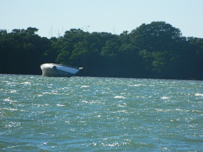
Someone wasn't quite as lucky,  It has been here long enough to be stripped from what we can see.

Our little motor?  We have had so many issues with the 9.9 Mercury Pro Kicker that I swore after last years $900 repair bill the next thing that broke I would give it to Davy Jones!  Being a bit more logical when the tilt switch failed and it didn't start by the third try I sold it.  We then bought a simi-used Mercury 3.5 for a good price to power the dinghy.  With the foreseeable battle with the state of Florida over our Walker Bay not having a title from Alabama we decided to put it on the main ship until we bought a dinghy we could store better on crossings.  The Walker Bay with the RID kit on the fore deck is a nightmare!  We also have a sail kit for it taking up space.  So we have some first hand experience with the little motor on the Vega now.
  • It will make 4.2 knots in calm water with the boat heavy stores for the Bahamas and dragging the dinghy.  
  • It will take 3-4 swells but not 3 foot chop.  
  • We normally burn 10 gallons with the old 9.9 from PC to Apalachicola.  With the 3.5 we burned only 5.  Wooo Hooo!  By the time we get from PC to Tampa we have usually burned 30 gallons,  This trip it is less than 10.
  • It runs it's little tank dry in about 42 minutes. (0.3 gallons/42 minutes @ full throttle) We need to make an attachment for the tank.
W


Sunday, December 23, 2012

Leaving the Emerald Coast 12-17,18

With The Fisher King wanting Calamari for lunch at the Seafood Grill we stayed in town a little longer than I wanted.  This gave us time since we were supposed to ship out an item at the post office but the recipient never sent an address.

Lunch was much better than last time!  The food has always been good but the last server brought all our appetizers, salads and entrees at the same time.  Knowing she shouldn't be doing this she played it off on the kitchen and laughed.  Okay, our money and she is laughing that part of our meal will be cold before we get to it.  DECISION TIME.  We want the food so we deal.  When she realizes how aggravated I am she tries to take the hot food back to sit under the heat lamp and dry out while wilting my lettuce, etc.  This is where my polite little negotiator steps in and tries to smooth things out.  He knows his dad doesn't do well with incompetent restaurant employees.  Zoom forward.  Time to pay.  Hmmmm.  Okay, sympathy tip of $1.  I should have asked to speak to the manager but I didn't want to deal with it that day.  As we left to cross the street here came our server flailing arms, fingers pointing and uttering words I can' understand.  All I could pick up was "keep your dollar!" as I returned the big smile and parade wave.  Nothing releases anger as much as placing it on someone else.   Hint: They advertise the Largest Fish Sandwich!


In the time we had before lunch I called the marina and asked about the pass with out a good answer they suggested Scipio Creek Marina.  Scipio said with 4 foot draft "no problem" just stay west of center!  But the real help was talking to the shrimp boat tied up a hundred feet from us.  They said and showed me on our chart.

 Thanks for the local info!
"Hug the east side of the alignment markers,  when you pass the second marker move west until you see the rear marker to the left of the second marker.  This will put you on the west side of the channel.  The east side is all shoaled up here.  "pointing"  BUT, do not go too far west as it is shallow over there too!   We draw 10 feet and have to be careful when we transition the cut!  You'l be okay just go slow.   Once past the jetties go ahead and turn toward Clearwater.  That way you will miss all the roller coaster stuff out by the channel markers"

Well how far is too far?  This is too far

All went good except we went just a little to far west!  The view above puts you at Vega in sand.  But not too deep that a little 3.5 couldn't push through with a 15 knot head wind.

Mr Pelican watching us leave

Once you clear these jetties it is safe to turn according to our information. 
We went out a couple hundred yards first.


The first one hundred miles were great!  Fifteen to 20 knots and mostly 4 foot plus seas.  Of coarse there were moments of 20+ and a few at 6 feet but that goes with the sustained winds for 20 hours.  As the wind clocked to the north our forecast called for 10-15 and we hoped to broad reach right in to Clearwater channel.  Well the north came!  At a massive 5 knots!  Occasionally there might be 7 or better but we were now bobbing along with big seas and very little wind to buffer our Weeble Wooble.   We chose the best point of sail that would not shake us to death and keep us going roughly the direction we wanted.   We settled in for the night barely making any head way.  

The next morning  the winds moved around but never gave us the ride we had for the first 100 miles.  Trying to wait out the wind and continue to sail we finally got bored and started the little motor on the lightly rolling seas.  We spent two hours trolling without luck.  Or at least that is what we thought until we wound in the line.  We had bad luck our lure was missing 75% looking like a big King had taken a bite and decided the rest wasn't for him.

The wind was just enough to keep on course but a slow 2 knots or so.  With no wanting to spend another night out in the Gulf waiting on wind.  We started the motor and motored the last 25 miles to Anclote Keys.  Our original destination was Clearwater channel but that would be well after dark and with the southerlies starting tonight for the next front we wanted to be at anchor and "inside" the barrier islands.

We anchored well off Anclote Key due to the lack of a depth sounder!  Yes this died in the intercoastal with the Lowrance!  We made Government cut without it.  We do have a piece of string and a lead weight.  But that is hard until The Fisher King gets a little better with boat control or acting on what I am thinking before I say it.

The next morning with the southerlies blowing at 15 knots we pulled anchor and started our motor test!


w

Les Cinq Misérables Miles 12-16

Well as we prepared to go forth unto Apalachicola we gave the Lowrance GPS one final try.  Power up, home screen, turn off.  It acts like an input is overloading or similar.  Perhaps the corroded 2000 input in the back is shorting out.  Anyway it is now an impending doom of repair costs.  It would be cheaper to buy a new smaller system.  We are looking into it.

This was my fourth time through this stretch of intercoastal.  I was hoping the last time was my final one.   No matter how nice White City Free Dock and the days we spend there are there must come the day we cross the miserable five miles of Lake Wimico.  This may be a freshwater fisherman's dream to have several species of salt water fish in his favorite bass fishing hole but,  the narrow little path that a sailboat can travel is a gauntlet.  The channel is dead straight once you are on the lake but the edges are very shallow and you have to watch that the cross wind doesn't put you off the center.  I dislike this section!

As we entered the lake of the dread we passed an on coming small cabin cruiser. Tortuga.  Tortuga was an Albin 27 and we took the moment to make a small conversation on channel 17.  They continued to stress "DO NOT TAKE GOVERNMENT CUT!  IT HAS NO WATER!"  We didn't even get where they were from or where they were headed, just "DO NOT TAKE GOVERNMENT CUT!  IT HAS NO WATER!" Our response of  "We have been through twice before" was met with "THIS INFO IS ONLY TWO HOURS OLD!  DON'T  TAKE GOVERNMENT CUT!"

Hmmm,  That would put a damper on our plan as going out to Dog Island is another 25 miles or so.  Taking the time to go all the way out there and planning on land fall at Clearwater cut was not logical.  That was assuming we could get through Government cut.  We would check on this tomorrow morning.

We were making way using the small Lowrance and occasion iPhone with Charts and Tides for our reference.  Dark fell before we arrived at Apalachacola but this being the forth time s/v Gemini Dreams has been to this town we knew the actual mouth to Scipio Creed is well south to the actual marker.  Cutting this too close leaves you up on the shoal with the crab pots.  Hint: if you go through the pots it is too shallow.     No matter what your chart says.

We normally tie up to the free dock just off Water Street.  This makes us have to deal with the rising and falling of the tides.  Another Vega owner said to just tie up to the dinghy dock and make it simple.  This worked out much better.  Just being able to step out onto the dock at any tide instead of climbing from the cabin roof up 4-5 feet to the dock.

w


Sunday, December 16, 2012

White City 12-14, 15

Resident Fisherman at White City


The Fisher King strutted his stuff at White City.  Showing me up once again!  I caught on small flounder and he caught two large flounders!

 First he caught this 20" flounder and rubbed it in

 I then caught a small 11 inch followed by this monster 21 1/2" by the Fisher King

 Prepped and ready to bake with crab stuffing

 Dinner at White City


He also found time to make a bow and arrow out of some fishing line and local trees.  He also found a feather to use as fletching and keep it straight.  He did an amazing job.

W

Navigation By Star Dust and Swamp Mist. 12-13-12

After running a few errands today we shoved off, departing the Emerald City.  For the beginning of the "End of the World" Cruise.  Have you noticed the papers say it is the begging of a new year, century or whatever and are playing down the long touted "End of the World".  Just like the hypocrites!  Trying to take all the fun out of MY sarcasm by back peddling on their beliefs.  Oh well we can still have a party!

Yes it was cold today!

Back to the sailing adventure.   We motor sailed through St Andrews and East Bay making way.  As we approached the narrowing intercoastal at Wetappoo Creek our Lowrance locked up as we went to change it to night vision.  Yes as the sky became black with the new moon we had no chart plotter.  After powering it down it would not go past the start up screen. No matter how many times we tried it would only show us what model it was and some fish on the back ground screen.

Our first sunset of the "End Of The World Cruise!" Just before the lights went out

As the Fisher King steered toward the last flashing light I pulled one of our back up plans out.  Another Lowrance that I use in the car.  It has a base map and kept us in the channel instead of following a winding dead end.  It didn't take long before we were using the tree tops as our chart plotter instead of that base map.  With no light from the moon the sky was just bright enough to reflect on the water ahead and lead the path.  The tri-light gave enough light to allow shadows on high points on the north bank.  Often we could not see or distance the right bank.  This being okay knowing where the danger on one side was.

After relaxing into the rhythm I was finally able to see what the Fisher King had been for over an hour.  "There's one!  There's one!  That way!"  he continued to shout.  He had been watching multiple shooting stars.  He could see the Milky Way and the planets.

Then the mist came!  Dampness drifting across the water.  Making everything wet and COLD!  It also brought back memories of "The Legend Of Boggy Creek".  We could no longer see the right bank even with the spot light.  We thought of anchoring for the night but the double length barge that crosses this stretch kept us from anchoring on the side of the channel.  Then if would open up and be clear again.  Clear as a dark night can be.  The mist continued to drift in and out of our path.  Then something off the starboard side caught my attention.  First it was the devils horns.  I assume it was the roots of a tree.  Second it was a tree, the trunk and roots breaking the water as it slowly drifted down the channel.  Finally on the port was another root ball too close for comfort.  It was at this time we ran out of gas.

As I refilled the tank I realized we were finally at the intersection just before White City Free Dock.  Knowing we were this close I chose to press on the final mile. Finally, safely tied up out of the current, it was time to get warm!

W

Tuesday, December 11, 2012

s/v Mini Pearl

We would like the thank the crew of s/v Mini Pearl for inviting us into their home for a wonderful dinner.

Dinner, ice cream and the company was wonderful.

Wes and Ayr

Saturday, December 8, 2012

Digital Explorer Charts Bahamas for only $30

Okay we will start with the disclaimer...  This is not a chart plotter!  Now that that is covered Wow that digital copy of the Explorer Charts you have been waiting for is now available.  Well kind of, sort of... the Garmin charts are based on the Explorer Charts.   Garmin has released (two weeks ago) a free (not really) iphone/ipad app for "navigational planning".  Garmin Blue Charts Mobile

Weather screen shot from Panbo

So what does this mean?
  1. The basic app is free
  2. You get the digital copy of the Explorer Charts for $30 and coastal US.
  3. Your iOS6 machine (except iPad 1) can show your position on these charts.
  4. Active Captain is overlaid!
  5. Weather is overlaid, another $4
  6. If you spent a crap load of money on a new Garmin it will net work if you spend another $200.
The bad?  It is not a chartplotter!  You have to look at the little red line you drew and follow it.  It can not draw the little red line for you or tell you which way to turn or how much longer till you get there.  

I recently had the chance to zoom in on a brand new Lowrance touch screen chartplotter to compare it to a Blue Chart system.  If you are going across the Gulf Stream there is still only one system to buy.  But if you are like us and have an older system from Lowrance or someone else this is a great way to supplemental the chartplotter with more accurate charts.  I am using the below screen captures from the current Active Captain newsletter to show the difference between Blue Charts (left) and Navionics (right) the Lowrance 38c charts are even less detail and further off.


In closing if you expect to get an $1800 or higher chart plotter for $30 you will be disappointed   If you expect to get a digital copy of the Explorer Charts that your device (3g & 4g) will show your position on you will get what you expected for $30.  There are a few other pluses too but this is our point of view.  

Activecaptain screen shot from Panbo


We have installed it on our iPhone and will on our "hopefully soon to have" iPad.  (The 7.5 pound toughbook is getting heavy! But it survived over the last year.)  

And here is a big bonus 
(Q) If I also have an iPhone, do I need to purchase BCM twice?
(A) Absolutely not. Download the app for free and click on Restore Purchasesin the BlueChart Maps page. That'll make everything available on your iPhone too.
But that's not all. If your spouse has an iPhone or iPad, you can load thesingle purchased copy on their devices too. Just have them log into your iTunesaccount before launching BCM. Once they do that, Restore Purchases will allowthe charts to run for multiple people. That's how we use it ourselves.

Full reviews here:

W

PS  You should still have a set of paper Explorer Charts on board!

Thursday, December 6, 2012

s/v Wee Happy Needs Adopted!


S/v Raindrop has a new owner but s/v Wee Happy is still available and advertised on the Craig's List.  Any takers?  Don?  A great chance to get a boat that has been there done that and wanting to do more!

s/v Wee Happy and s/v Gemini Dreams at Bahia Honda

 s/v Wee Happy at Bush Key

 s/v Wee Happy taken from Fort Jefferson, Dry Tortugas

 s/v Wee Happy arriving the Marquesas Keys

 Sunrise Departure

s/v Wee Happy at Boot Key Harbor


Albin Vega Sail Boat - $7500 (St. Augustine FL)


Date: 2012-11-06, 1:51PM EST


This is not a project boat. She is upgradable, but is not a project. Ready to sail away.

12/6/12: Just had the boat hauled out today and put on the hard for an inspection and a bottom job. The Honda 8hp outboard has a new lower unit and oil change and water pump impeller and gaskets. It's running fabulously. The bottom looks good. Already scraped and pressure washed, and next sanding and then new hard ablative antifouling paint. Also now including color GPSmap551s Chart Plotter with Bahamas and East coast US charts and 2010 Raymarine tiller autopilot.

Due to the overwhelming interest in the boat and the extra work and money that I am putting into her before the sale, the asking price is now $7,500 or best offer. Will consider a trade for a car or minivan of similar value or a partial trade and balance in cash. Relaunch of the boat is included in the sale, and of course you can continue to keep her on the hard in the do it yourself work yard where she is now in St. Augustine FL for about $250 a month.

She is turn-key and ready to go to the Bahamas, complete with recent electronic charts, chartplotter, and autopilot now. I was going to keep those items, but now I'm including them in the sale, so she is absolutely turn-key. Just fly or drive here and take her across the gulf stream in the next weather window.

A complete suite of photos and video coming soon. Serious inquiries only please. I have too many people emailing me about this boat to be able to handle all the interest from people who want to low-ball me. She is a bluewater cruiser, extremely seaworthy, and ready to go. Excellent first boat or solo cruiser.

She has her original Volvo inboard diesel and combi prop still, but it hasn't been run in a year. I do turn it over regularly however. The motor should be fine and start without much work, but the combi and variprop need to be cleaned and greased up to free them up. I may do this in the next couple of weeks, in which case I will not include the honda outboard with the sale, and the asking price of the boat will go up again since she'd be offered with a bulletproof diesel and vaiable pitch prop! If you want to take her as she is right now and free up the combi and vari prop yourself, then you'll have a sweet $1,000 honda outboard to sell when you are done.

This is a northern boat. She was sailed over to America across the Atlantic from Sweden in 1972 and then lived on fresh water Lake Champlain 3 months a year for each year of her life. The other 9 months a year she was kept in a cradle on the hard, and it shows. We just brought her to Florida and the Bahamas, and she's been in the south for about 2 years. She is very dry and you rarely need to pump the bilge. The gelcoat is good for its age because she was a northern boat, but there are of course nicks and cracks and dings and such that could be filled and beautified. I just always focused on structural and functional improvements to the boat rather than cosmetic.

For example, in the last two years I replaced the sacrificial sunbrella strip on the roller furler, I installed a anchor roller and through deck hawse pipe. I upgraded the main anchor to a bruce, got good chain and an swivel. I addressed the weak points of the vega: the bow/forestay chainplate has been reinforced, the mast support beam reinforced with 1/4" stainless plate, and the lifelines upgraded to modern high strength dyneema line. I installed a dodger, autopilot and chartplotter and made new cockpit locker lids. Upgraded the head to a unit with a pump out and holding tank.

Delivery available to anywhere in the world on her own bottom at a cost of $300 a day plus expenses.

Now back to the old ad...

--

1972 Albin Vega

Good condition. Almost ready to sail away: Getting the motor fixed up this week, and then she'll be ready to go to the Bahamas or anywhere else you want to take her. She's in good sailing condition, and is a great value for the price. Priced to move. She's not a project boat, although of course she's upgradable. Will consider trade for a car or motorcycle of similar value.

Good sails (150 genoa & main)
Roller furling jib
Good dodger
Good rigging
Stern grill (propane)
Good VHF & masthead antenna
all recent LED lights in cabin
LED running lights
Roller furler, mainsail cover, dodger, and grill cover are all dutch blue sunbrella.
Recent bow anchor roller & claw anchor & through deck hawse pipe
Recent sacrificial sunbrella strip on roller furled genoa
Recent cockpit locker lids
Recent bilge pump
Recent compass
Recent running rigging
Recent galley stove (two burner alcohol)
Recent head (with 5 gal holding tank)
Recent salon upholstery
Recent deep cycle battery and 40w solar panel mounted on cabin top
2003 Honda 8hp BF8D outboard on stern bracket w/battery charger and electric start. runs great
Volvo MD6A diesel inboard w/ combi prop hasn't been run in a year. I turn it over every month or two though.


 You can't get to here without a boat!  The Ferry stops 2.5 miles too soon!

A day at Loggerhead Key s/v Wee Happy

Untouched sunset photo Boot Key Harbor
s/v Wee Happy is a couple boats behind the camera

And some shots from the blog of the s/v Wee Happy

Allens Cay Bahamas

A rainbow on the ICW

Anchored in the Saugerties, NY

Okay Kristopher I sold the dream now you sell the boat! lol
W


tags: Albin Vega sailing vessel sailboat Wee Happy for sail sale Florida Saint Augustine Keys Key West Marathon Largo Port Charlotte Tampa Clearwater St Petersburg Annapolis buzzards bay panama city pacific northwest washington oregon canada mexico Bahamas Norman Normans Norman's Carlos Lehder Bimini Staniel Cay voyage Voyaging around the world owners group liveaboard live aboard baking bread pressure cooker headroom solar wind generator fishing 

Wednesday, December 5, 2012

The Reindeer Got Ran Over By The Sailboat...


The Reindeer Got Ran Over By The Sailboat.
Sailing south from it's hurricane hole.
You can say there's no such thing as Santa,
But as for me and Tinman, we believe.

We'd been grillin' that there roadkill,
Sitting down to eat we just can't help but wonder,
if it was not poor dear Rudolph.
Guiding dear old Santa's sleigh.


Rudolph on the barbie

With the loss of his reindeer Santa is trying new applicants

Fresh venison as good as any other reason for a party.  We will definitely miss this group of cruisers when we sail away.


ROTFLMAO,  BED HEAD


W